
The Himalayas of India: Ladakh and Dharamsala,
Summer 2008
Ladakh - Basgo, Rivers, Ancient Christian Markings, and the Highest Saltwater
Lake
Page 5 of 16
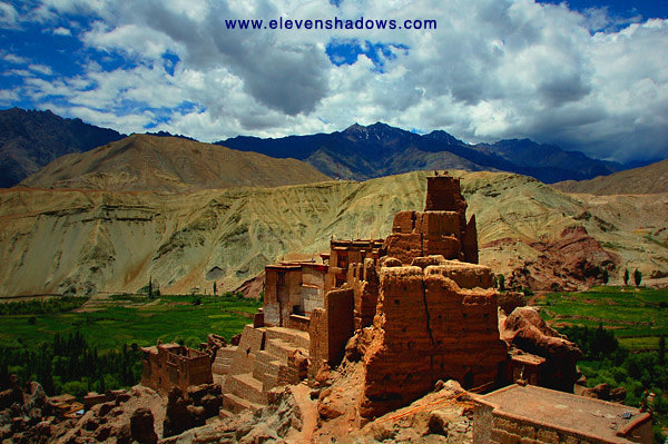 The
Basgo Gompa is the former capital of lower Ladakh, and the 400 year old
gompa can be reached by walking up some winding staircases. Parts of
the gompa are dilapidated, while other parts have been kept in good shape or
been restored. The
Basgo Gompa is the former capital of lower Ladakh, and the 400 year old
gompa can be reached by walking up some winding staircases. Parts of
the gompa are dilapidated, while other parts have been kept in good shape or
been restored. |
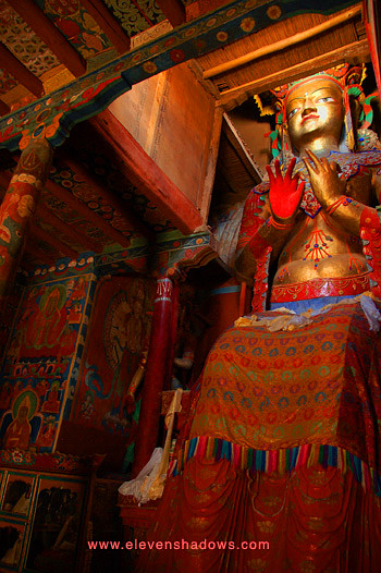 Basgo
Gompa houses some fantastic frescoes and this enormous copper and gold
statue of the Maitreya Buddha. Basgo
Gompa houses some fantastic frescoes and this enormous copper and gold
statue of the Maitreya Buddha. |
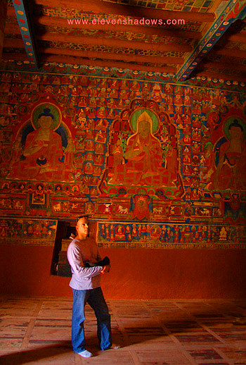 Tom
admiring the giant Maitreya Buddha statue and the intricate wall frescoes
inside the Basgo Gompa. Tom
admiring the giant Maitreya Buddha statue and the intricate wall frescoes
inside the Basgo Gompa. |
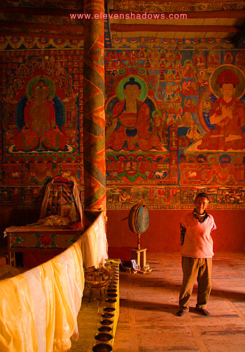 The
other wall inside the Basgo Gompa, with the very friendly attendant monk
giving us a tour. The
other wall inside the Basgo Gompa, with the very friendly attendant monk
giving us a tour.We walked back down the winding stairs and back to the car, where we continued a little bit further up the road, paralleling the mighty Indus River. |
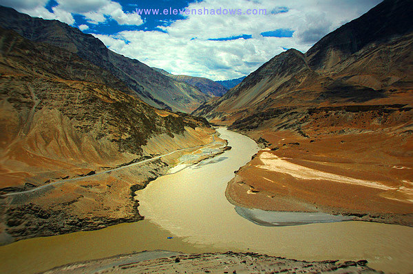 I
had read about the convergence of the Indus and Zanskar Rivers at Nimmu.
The darker brown-colored Indus is to the left, with the lighter-colored Zanskar
River flowing into the Indus, feeding it and continuing its journey, flowing
down to Pakistan before
emptying into the Arabian Sea. I
had read about the convergence of the Indus and Zanskar Rivers at Nimmu.
The darker brown-colored Indus is to the left, with the lighter-colored Zanskar
River flowing into the Indus, feeding it and continuing its journey, flowing
down to Pakistan before
emptying into the Arabian Sea.
Namgyal, originally from Zanskar, told me that he had walked up the Zanskar River, through the valley, for five days during the winter when it was frozen over to return to his home village there. |
 8
July - Today was my turn not to feel well. I had shivers part
of the day and no energy or appetite, so I drank absurd amounts of water and
stayed in bed most of the day. Tom climbed up Leh Palace and Tsemo
Gompa in the evening while I rested. I eventually took a Vicodin and
drank another bottle of water, and began to feel better in the evening. 8
July - Today was my turn not to feel well. I had shivers part
of the day and no energy or appetite, so I drank absurd amounts of water and
stayed in bed most of the day. Tom climbed up Leh Palace and Tsemo
Gompa in the evening while I rested. I eventually took a Vicodin and
drank another bottle of water, and began to feel better in the evening.~~~~ 9 July - The next day, we parted ways, with Tom flying to Delhi and going to Dharamsala, while Delek drove me to Tangtse and Pangong Tso. On this route, we drove over the Chang La, which at 5599m. (17800 ft) was the third highest motorable road in the world, where the truck driver on the left stopped for free tea provided by the Indian government. I was on my way to Tangtse to view the ancient Aramaic Christian inscriptions left on the mysterious boulders, an ancient lost language used by people in Jesus' time in what is now Israel. Historically, Tangtse had been an important stop along the ancient trade routes. Had people traveled from what is now Israel and carved crosses and Aramaic inscriptions in the 1st or 2nd Century? We stopped at the Dothguling Guest House in Tangtse, a tiny village at 4000m (13120 ft), ate some rice and dal, and later, set out on foot to try and find these mysterious boulders. |
|
Ancient Christian Markings on the Mysterious Tangtse Boulders
In the late afternoon, Delek, his cousin Spanzin (who lived in Tangtse), and I set out on foot to try and find the mysterious boulders with Christian crosses and ancient inscriptions. Some scholars point out that the Nestorian Christians came this way in the 6th century, and likely carved the crosses and writing. Some believe the writing is Aramaic, an ancient lost language used by people in Jesus' time in what is now Israel. They argue that it cannot have been carved by the Nestorians, as Aramaic died out before the 6th century, and was more likely carved in the 1st-2nd century. And still others insist that the writing is Sanskrit. We came to a farm house. Spanzin described the writing to the woman outside and asked if she knew of it. She pointed to two large boulders just behind her house and took us there. She asked why people kept coming to see the writing. Spanzin explained to her that it could be early Christian writing from the 1st or 2nd Century, and the people coming to see them were mostly scholars and researchers. "I've been living here all my life and I never knew what these were!" she exclaimed excitedly. But her excitement gave way to a look of concern. She asked Spanzin if anything would happen to her house. He chuckled and assured her no. She followed us around, knitting and smiling, as we scrambled on top of the boulders, taking photos. Spanzin had been so fascinated upon hearing about the writing that he too had brought his camera. The first boulder, closest to the woman's house, had by far the most amount of mysterious carvings. We could see very different writing that was clearly not Ladakhi writing and three crosses. The second boulder, slightly farther back, had some unusual inscriptions as well, but not as many as the first, larger boulder.
|
 After
photographing the mysterious inscriptions on the boulders, Delek, Spanzin,
and I were buzzed with excitement over our discovery, wondering what exactly
it was. We then started walking through the valley towards the Tangtse
Monastery, following a path of rocks flanked by walls of mani stones. After
photographing the mysterious inscriptions on the boulders, Delek, Spanzin,
and I were buzzed with excitement over our discovery, wondering what exactly
it was. We then started walking through the valley towards the Tangtse
Monastery, following a path of rocks flanked by walls of mani stones. |
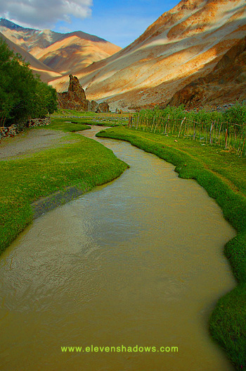 We
continued along the path going up the valley, crossing a lovely stream (see
photo),
walking up towards Tangtse Monastery. Along the way, we saw more
carvings that looked like the animal and spiral carvings on the two
boulders, although we didn't see any more crosses or Aramaic-looking
writing. We
continued along the path going up the valley, crossing a lovely stream (see
photo),
walking up towards Tangtse Monastery. Along the way, we saw more
carvings that looked like the animal and spiral carvings on the two
boulders, although we didn't see any more crosses or Aramaic-looking
writing.Along the way, Spanzin commented ominously, "Maybe many years from now, people will be looking at the Ladakhi writing on the boulder in the same way." He explained that in most schools, Ladakhi kids are taught Hindu and English, but not Ladakhi. Spanzin's words would echo in my head later when I saw a video showing the state of education in Ladakh and seeing an elementary school textbook and its devastating commentary of traditional Ladakhi life at the Women's Alliance in Leh. |
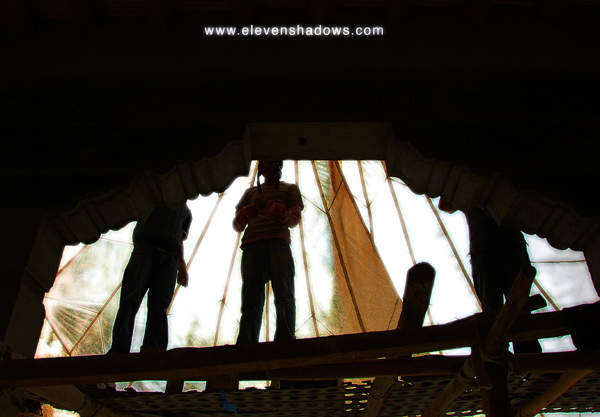 Much
of Tangtse Monastery's "chapel", as Spanzin called it, was still being built, although there was a clearly older,
smaller part of the monastery already there. Much
of Tangtse Monastery's "chapel", as Spanzin called it, was still being built, although there was a clearly older,
smaller part of the monastery already there.
Painters stood on scaffolding, creating intricate and colorful frescoes in the front of the temple "chapel". Spanzin said that all the workers are there voluntarily. We walked inside one of the older temples, which used the side of the mountain as one of the walls. We were offered orange Fanta. |
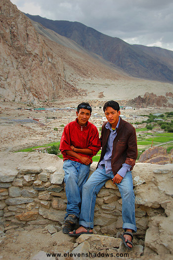 Delek
and Spanzin, pictured here, walked up to the gompa on top of the hill, which
offered great views of the village of Tangtse and the small town of Durbuk
beyond. Delek
and Spanzin, pictured here, walked up to the gompa on top of the hill, which
offered great views of the village of Tangtse and the small town of Durbuk
beyond.
We walked back down the other side of the gompa, walking back to Tangtse on the road that leads to Pangong Tso. Upon entering the town, we spoke with a group of men who expressed great interest in what we had to say about the writing, and wondered how I had found out about it. "Was it a foreign book?" asked one. They took turns looking at my camera as I showed them the photos we had taken. "This writing is definitely not from here," exclaimed one, "this looks Arabic!" The others agreed. Delek and Spanzin both said that they had a great time on the walk. I agreed. This was by far my favorite part of the trip so far. Tangtse was at 4000m (13120 ft), but I had felt great on the entire walk, and my stomach problems had vanished. I rested at Dothguling Guest House, but then, feeling restless, I walked back up to the boulders. The woman was outside, and upon seeing me, she laughed heartily and asked me in for dinner, miming eating food. I thanked her but declined, saying that I wanted to see the boulders again, and she nodded. The light was gorgeous, and I photographed some of the boulders again. After this, one of the women at Dothguling took great interest in the boulders. "I've lived here all my life, and walk past those boulders all the time. I knew that writing was different, but didn't stop to think what it might be." She mused that maybe someday my photos would make it into a book. I smiled and hoped she was right. |
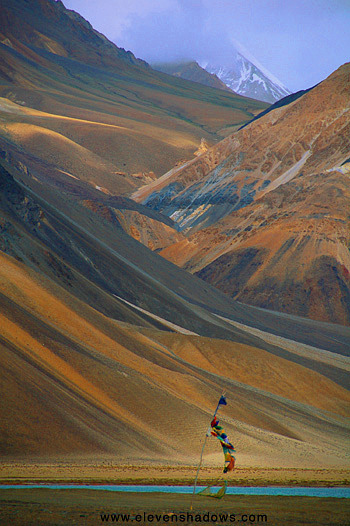 I
was treated to a delicious dinner with timmu, soft rolled-up doughy things,
paneer (cheese) dal (lentils), and curd for only 80 rupees. I sat in a Tibetan-style
living room just off the kitchen, sitting on raised Tibetan carpets and
eating on little Tibetan tables. The dinner was as delicious as the
lunch had been bland before, and was pleased at the turnabout, a nice way to
end an exciting, fun day. I
was treated to a delicious dinner with timmu, soft rolled-up doughy things,
paneer (cheese) dal (lentils), and curd for only 80 rupees. I sat in a Tibetan-style
living room just off the kitchen, sitting on raised Tibetan carpets and
eating on little Tibetan tables. The dinner was as delicious as the
lunch had been bland before, and was pleased at the turnabout, a nice way to
end an exciting, fun day.I slept soundly. It was extremely quiet in Tangtse. ~~~~ 10 July - In the morning, Delek and I left for Pangong Tso, a bit higher at 4300m (14104 ft). I had been at Pangong Tso, the world's highest salt-water lake, eleven years ago. But on that day back then, there had been no wind, and the lake was like glass, reflecting like a mirror. However, on this day, a cold wind whipped fiercely, and the day was rainy and cloudy. Still, though, the mountains were gorgeous, even as my ears grew cold while walking around the shores of the salt-water lake. |
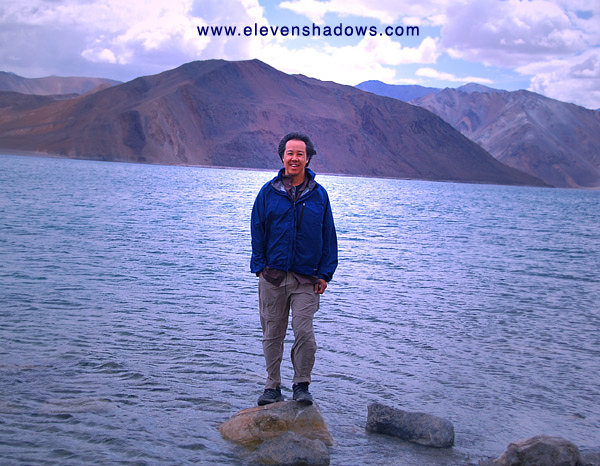 Delek
took this photo of me standing by the shores of Pangong Tso, the cold wind
whipping at us constantly. We looked at the camp nearby, seeing
several Indian tourists huddling in winter coats. As it got brutally
cold and windy at night, we wondered why anyone would want to camp there. Delek
took this photo of me standing by the shores of Pangong Tso, the cold wind
whipping at us constantly. We looked at the camp nearby, seeing
several Indian tourists huddling in winter coats. As it got brutally
cold and windy at night, we wondered why anyone would want to camp there. |
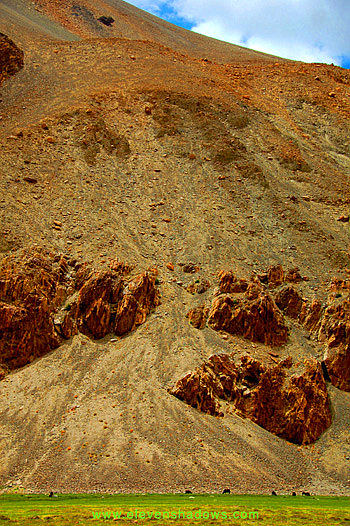 After
an hour at Pangong Tso, Delek drove back down the valley towards Tangtse,
and we saw some nomads herding their yaks and sheep against the backdrop of
giant rocky mountains. After
an hour at Pangong Tso, Delek drove back down the valley towards Tangtse,
and we saw some nomads herding their yaks and sheep against the backdrop of
giant rocky mountains.The valley changed character several times, from messy boulder-scapes to sand with tufts of long grass poking through to emerald grass with a snaking tiny green stream curling around in semi-circles to reflective ponds of water. Several times we saw horses or yak grazing. Sometimes we could see stone fences, pens for sheep and goats that the nomads had built. |
|
|
 Ladakhis,
to live in this often inhospitable environment, are very good at irrigating
the water from the melted snow that runs down from the peaks. Ladakhis,
to live in this often inhospitable environment, are very good at irrigating
the water from the melted snow that runs down from the peaks.
|
The Himalayas of India: Ladakh and Dharamsala, Summer 2008
Page 5 of 16
1 2 3 4 5 6 7 8 9 10 11 12 13 14 15 16
Eleven Shadows Travel Page
Contact photographer/musician Ken Lee