Death Valley For New Year's Eve, 2009-2010
Page 3 of 3
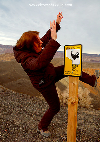 Lisa
attempts to use caution near the edge of the Ubehebe Crater, Death Valley,
California, to begin the 2010 new year on a safe and sane note. Lisa
attempts to use caution near the edge of the Ubehebe Crater, Death Valley,
California, to begin the 2010 new year on a safe and sane note. |
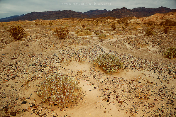
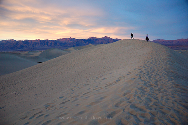
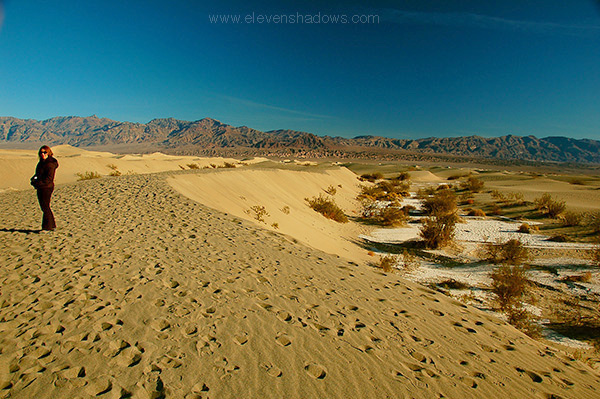
 There
are few things better than walking on the tops of sand dunes during sunset
and listening to the desert silence whispering in your ear. There
are few things better than walking on the tops of sand dunes during sunset
and listening to the desert silence whispering in your ear.
Lisa was chilled from the cold cloudy day, so she dropped me off at the Mesquite Sand Dunes, the same area we had been on New Year's Eve. Mesquite Sand Dunes has 100 ft. tall sand dunes. Sand dunes cover less than one percent of Death Valley, but we were fortunate to have our giant sand box only two miles from where we were staying. Crawwwwling up one of the tallest sand dunes in the waning light of the desert sun.
|
 I
immediately set out out for the tallest of the dunes, located farthest back,
walking on the tops of the sand dunes most of the time. I
immediately set out out for the tallest of the dunes, located farthest back,
walking on the tops of the sand dunes most of the time. |
 Walking
further back in the Mesquite Sand Dunes. Everything I wanted was
around me: my camera, a bag of Brazil nuts, two liters of water, warm
clothes, sand dunes, and a sunset. Walking
further back in the Mesquite Sand Dunes. Everything I wanted was
around me: my camera, a bag of Brazil nuts, two liters of water, warm
clothes, sand dunes, and a sunset. |
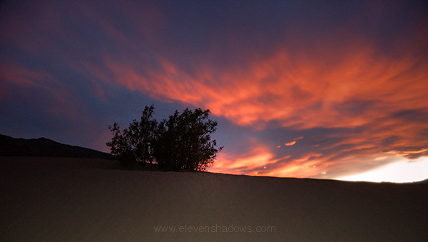 Shortly
after the sun melted into the mountains, I witnessed the spectacular fiery
red clouds that I've only ever seen in the desert sky. Shortly
after the sun melted into the mountains, I witnessed the spectacular fiery
red clouds that I've only ever seen in the desert sky.
|
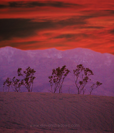 The
fiery red cloud sunset over Death Valley. The
fiery red cloud sunset over Death Valley. |
 2
January 2010: When you are staying only two miles from such a
fantastic sandbox, can you resist? We couldn't either. We
answered the clarion call of the dunes and went out for a morning climb. 2
January 2010: When you are staying only two miles from such a
fantastic sandbox, can you resist? We couldn't either. We
answered the clarion call of the dunes and went out for a morning climb. |
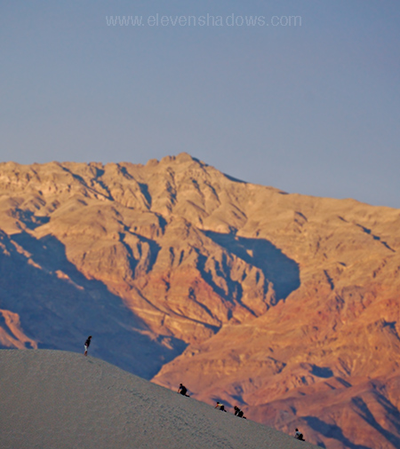
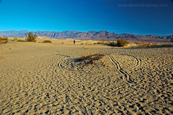
 Lisa
at Mesquite Sand Dunes in the morning desert light. Lisa
at Mesquite Sand Dunes in the morning desert light. |
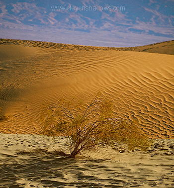 A
lone tree scratches out a tough existence in the sand dunes. A
lone tree scratches out a tough existence in the sand dunes. |
 Lisa
climbing another dune. Lisa
climbing another dune. |
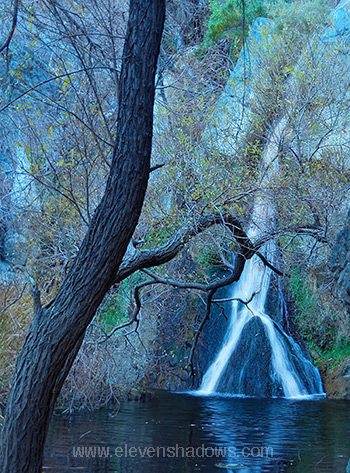 Lisa
and I drove over the Panamint Mountain Range and bumped along a dirt road,
then hiked up a mile path to Darwin Falls. Lisa
and I drove over the Panamint Mountain Range and bumped along a dirt road,
then hiked up a mile path to Darwin Falls. |
 And
a little further on, Father Crowley Vista, a landscape of dark lava flows,
volcanic cinders, and the the northern Panamint Valley spread out below. And
a little further on, Father Crowley Vista, a landscape of dark lava flows,
volcanic cinders, and the the northern Panamint Valley spread out below.We continued out of the Park, driving south with the breathtaking Sierra Nevada range out our right window, across the Mojave,. and back home. |
| Why is it called Death
Valley? In 1849, a group of explorers, lured by tales of California gold, headed West. They met up October 1849 with a guide who offered to take them to the gold fields. Only a couple of years before, a group of pioneers known as the Donner Party left late out of Salt Lake City and was trapped by a storm, with some resorting to cannibalism to survive, so the party was keen to get moving before the snow hit. However, the first couple of weeks on the Old Spanish Trail went slower than expected. However, a young man rode into camp as arguments began, showing them a map from explorer John Fremont indicating a shortcut to the fields of gold near Walker Pass. That most of the map showed "unexplored territory" did not deter the group from trying to shave 500 miles off the trip. Most of the group decided to go this way, and 100 covered wagons begun the ill-fated journey. Dying of thirst, their lives were saved by a snow storm. The group continued north through what is now Death Valley Junction, going north on what is now Hwy. 190, where Lisa and I comfortably drove to see the sights in the cool air of winter. At where present-day Stovepipe Wells exists, they arrived
on Christmas Eve 1849, finding a water spring, but also finding yet another
impassable mountain area. An elderly man, exhausted and half-dead from
his long travels through Nevada, died in Death Valley, giving the enormous
valley its present name. They decided to leave their belongings and walk to civilization. Near the sand dunes that Lisa and I explored, they burned their wagons, slaughtered several of their sickly water-deprived oxen, and used the wood from the wagons to cook the oxen and make jerky. They then walked over ountain passes until encountering the even more impenetrable Sierra Nevadas. They turned south, heading to where Ridgecrest now is, eventually following a trail that is now Hwy 14, walking right past Walker Pass, the place they had set out to look for three months earlier. Weary of months of difficult travel through the desert, dehydrated and low in spirits, one can only imagine how royally it sucked to come across what was to be the worst part of their journey: crossing the Mojave Desert, a dry, featureless plateau with few water sources. They drank from puddles of water and ice from a recent storm to prevent dying from thirst. They made their way through a mountain pass near Palmdale, followed the Santa Clarita River drainage downstream, and were finally discovered by Spanish cowboys from Rancho San Fernando near present-day Newhall.
|
Death Valley California 2009-2010
Page 3 of 3
Eleven Shadows Travel Page
Contact photographer/musician Ken Lee