
The Himalayas of Los Angeles
Snow on the San Gabriel Mountains, Haines Canyon, Tujunga, CA - 23 January 2010
Page 1 of 1
 I
stood in the parking lot at my work with the principal and custodian,
admiring the snow on the San Gabriel Mountains. I felt like I could reach
out and touch them. So I figured I'd do just that the next day. I
stood in the parking lot at my work with the principal and custodian,
admiring the snow on the San Gabriel Mountains. I felt like I could reach
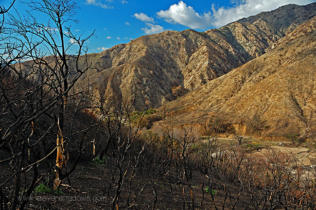
out and touch them. So I figured I'd do just that the next day.However, the Angeles Highway was closed. So was Big Tujunga Canyon. The August 2009 Station Fire had laid waste to the Angeles Forest. And now with the rains, there was danger of mudslides. Finally hiked up Haines Canyon in Tujunga. It wasn't the snowy peaks I'd hoped for, but the day was beautiful. I had often hiked this canyon two times a week with my dog when I lived nearby. However, the eerie charred landscape from the fires 4-5 months ago - the fire had lasted for over a month - gave me shivers even as the day was gorgeous. |
 A
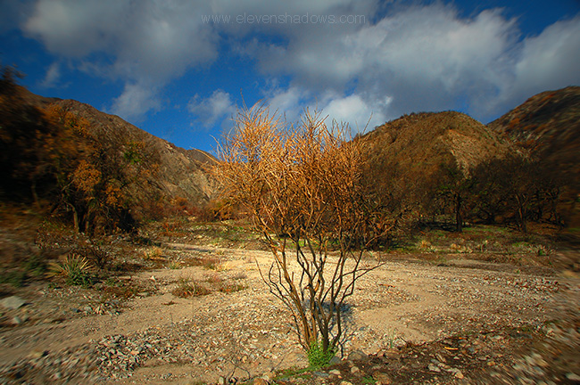
miraculous survivor of the fire at the first big turn before the second gate
as the trail forks, with the trail to the right heading up beyond the canyon
towards Mount Lukens. That's the way I would go today, Nikon D50 and
lots of water in hand. A
miraculous survivor of the fire at the first big turn before the second gate
as the trail forks, with the trail to the right heading up beyond the canyon
towards Mount Lukens. That's the way I would go today, Nikon D50 and
lots of water in hand. |
 I
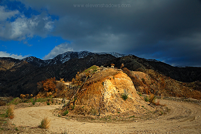
used to hike to this overlook twice a week with my dog. You'll see the
view over Crescenta Valley soon, very soon. I
used to hike to this overlook twice a week with my dog. You'll see the
view over Crescenta Valley soon, very soon.Regret echoed in my head occasionally on the hike. As photographers, we photograph places and people that give us inspiration or love. And I found myself filled with sadness at never bringing a camera to Haines Canyon or Trail Canyon Trail before the Station Fire. What would Trail Canyon Trail be like now? Or Buckhorn? Had my favorite groves been burnt to the ground? But I also knew it would grow back. This was my first visit since the fire, and I could see life already sprouting from the ground, emboldened by the life-giving rain. It'd be back. |
 The
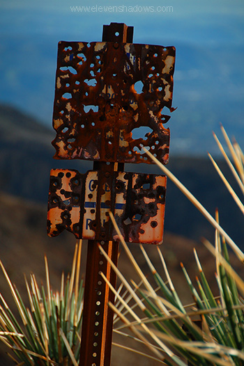
charred remains of a metal sign along Haines Canyon. The
charred remains of a metal sign along Haines Canyon. |
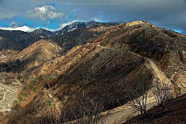 Up
up up Haines Canyon, the snowy peaks of the San Gabriel Mountains welcoming
me back. Up
up up Haines Canyon, the snowy peaks of the San Gabriel Mountains welcoming
me back. |
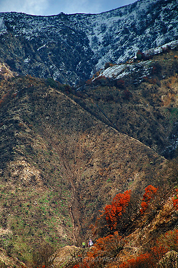 Hikers
descending Haines Canyon, Mount Lukens towering above us. Hikers
descending Haines Canyon, Mount Lukens towering above us. |
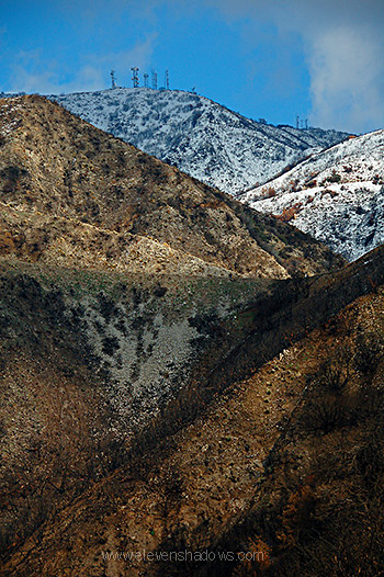 The
peak of Mount Luken and its radio towers, here covered in snow from the most
recent storms, is about a five mile hike from the trailhead. The
peak of Mount Luken and its radio towers, here covered in snow from the most
recent storms, is about a five mile hike from the trailhead. |
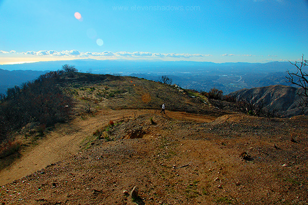 Although sorry for the devastation of the fires, the trail brought back a lot of fantastic memories. I used to hike the trail in Haines Canyon to this spot here, overlooking Haines Canyon. I'd throw sticks for her to fetch, and then we'd hang out, munch on a sandwich, maybe read a magazine, and then head back home. It was pure bliss. I miss that about living in Crescenta Valley. The beautiful mountains were so easily accessible.
|
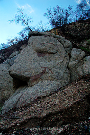 A
large rocky formation along Haines Canyon becomes a face in the hands of
some creative hiker. A
large rocky formation along Haines Canyon becomes a face in the hands of
some creative hiker. |
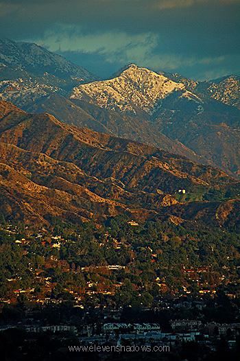 The
Himalayas of Los Angeles, the mighty San Gabriel Mountains, shoved up
violently through eons of tectonic shifts, covered in snow, illuminated by
the buttery glow of another gorgeous sunset. The
Himalayas of Los Angeles, the mighty San Gabriel Mountains, shoved up
violently through eons of tectonic shifts, covered in snow, illuminated by
the buttery glow of another gorgeous sunset. |
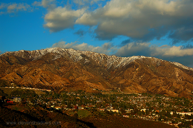 Another
view of Mount Lukens and the San Gabriel Mountains from across the 210
Freeway looking towards Tujunga and La Crescenta. Another
view of Mount Lukens and the San Gabriel Mountains from across the 210
Freeway looking towards Tujunga and La Crescenta. |
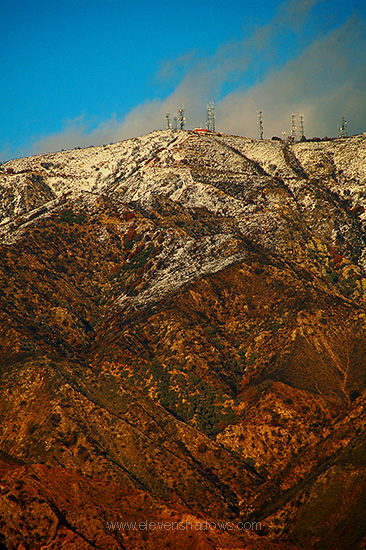 Another
view of Mount Lukens, covered in snow from the recent storms, the highest
point in Los Angeles at 5080 ft. (1550 meters). Another
view of Mount Lukens, covered in snow from the recent storms, the highest
point in Los Angeles at 5080 ft. (1550 meters). |
 On
the way home, I saw this gorgeous old farmer's truck in Lakeview Terrace. On
the way home, I saw this gorgeous old farmer's truck in Lakeview Terrace. |
 Beautiful
Thing, my old dog that hiked all the trails around Haines Canyon with me.
In this photo, she was ten weeks old. For years, we hiked Haines
Canyon and our favorite, Trail Canyon Trail, where we would walk up past
babbling creeks, groves of eucalyptus, and towering canyons to a large
waterfall. I can't help but wonder if the groves of trees or the trees
by the waterfall somehow miraculously survived. Beautiful
Thing, my old dog that hiked all the trails around Haines Canyon with me.
In this photo, she was ten weeks old. For years, we hiked Haines
Canyon and our favorite, Trail Canyon Trail, where we would walk up past
babbling creeks, groves of eucalyptus, and towering canyons to a large
waterfall. I can't help but wonder if the groves of trees or the trees
by the waterfall somehow miraculously survived. |
The Himalayas of Los Angeles
Snow on the San Gabriel Mountains, Haines Canyon, Tujunga, CA
Page 1 of 1
See Ken's photos at www.kenleephotography.com
Los Angeles and Miscellaneous Photos Page
Eleven Shadows Travel Page
Contact photographer/musician Ken Lee