Northern California: Humboldt and the Lost Coast, Northern California, July 2011: Look Prairie Trail, Shelter Cove, Black Sands Beach
Page 2 of 4
![]()
The next day, Monday the 18th, Lisa and I hiked up the Look Prairie Trail. This was listed on the Humboldt Redwoods SP website as strenous. But we laugh in the face of it all, daring the trail to make us fatigued. Yeah. |
"Look Prairie Multi-Use Trail Out & Back This trail climbs from the redwood forest floor, through an open prairie that offers stunning views, and into a mixed old growth douglas fir and redwood forest that is unrivalled in its beauty and diversity. This is a strenuous hike that rewards the adventurous hiker. Turn around at Peavine Ridge or follow the next hike for a long loop. Trailhead: Base of Look Prairie Multiuse Trail, 4.0 miles west of Avenue of the Giants on Mattole Road. Length: 7.0 miles roundtrip Time: 4.5 hours." - Humboldt Redwoods State Park website. |
We want something that is functional, lightweight, sturdy, but beautiful. In short, we need the best. That'd be Appalachian Walking Sticks hand-crafted in West Virginia by Paul Kelly. Yeah. That's right. Throughout these Northern California hikes, you'll see these fine sticks in action.
|
Lisa using Appalachian Walking Sticks on the Look Prairie Trail in Humboldt. |
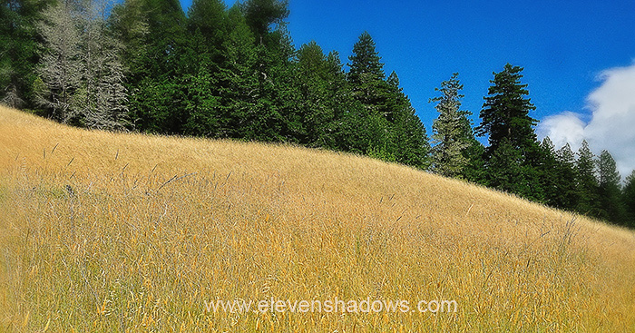
 Is it a meadow or a prairie? You decide. We'll walk through 'em. Is it a meadow or a prairie? You decide. We'll walk through 'em. |
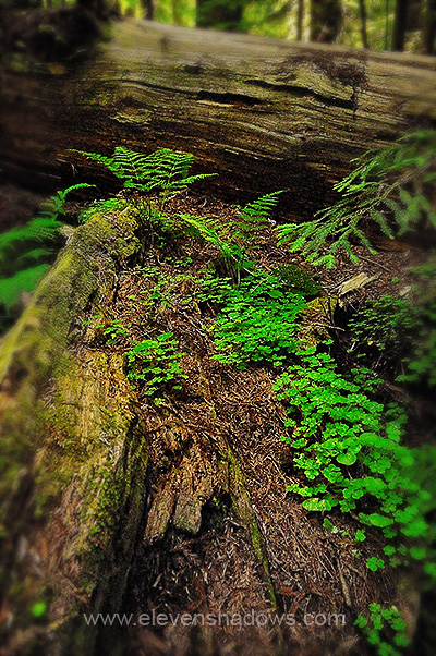
 A fallen redwood trunk, such as this one in Founder's Grove, is home to many different species of plants and animals, occasionally including some humans, who have hollowed out a trunk to create a home. A fallen redwood trunk, such as this one in Founder's Grove, is home to many different species of plants and animals, occasionally including some humans, who have hollowed out a trunk to create a home. |
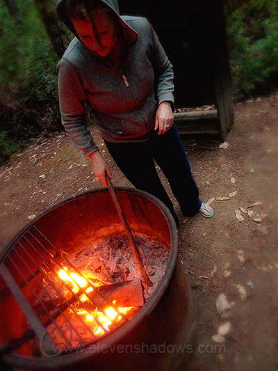
 Lisa gets a fire going while I screw around with the camera. Are you seeing a pattern here? Lisa gets a fire going while I screw around with the camera. Are you seeing a pattern here? |
After several days in Humboldt Redwoods, we made our way deeper, deeper into the Lost Coast, driving a twisting, winding road for an hour from our campground to get to Shelter Cove. LOST COAST You are building the Pacific Coast Highway. You go north of Ft. Bragg, north of Westport, and suddenly, you encounter enormous steep rugged mountains that that suddenly thrust upward, 2000 ft. in 2 miles. If this isn't challenging enough, you find that it's an active earthquake zone, home to a geologic triple junction where the San Andreas Fault meets the Mendocino Fault and the Cascadia subduction zone, separating three tectonic plates. What would you do? Yeah, that's right, you'd go around. Pacific Coast Highway abruptly dives eastward and inland, following Cottaneva Creek through redwood-forested mountainous terrain before meeting Highway 101 near Leggett. The Lost Coast is the most isolated stretch of coast on the West Coast, and one of most isolated areas in California as well. There are no highways, only a few twisting roads that would make Ice Road Truckers nervous, and a lot of bumpy twisting dirt roads which are often impassable during rain or winter season.
|
|
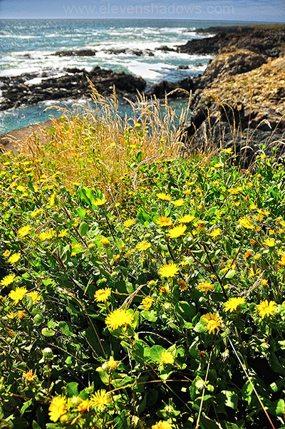
 Shelter Cove, Lost Coast. Shelter Cove, Lost Coast. |
This is that lighthouse. However, this isn't Cape Mendocino. Progress caught up the lighthouse. The actual light was moved, and only the tower remained, where it was ravaged by vandals, and due to crumbling cliffs, threatened to tumble off the cliff into the sea. In 1998, the Cape Mendocino Lighthouse Preservation Society moved the tower to Shelter Cove, thirty miles south of Cape Mendocino.
|
The Lost Coast region is one of the fastest rising land masses in the world. However, it doesn't come close to rising to the heights of the Himalayas due to heavy erosion and weather. The wind was fierce, and it was challenging to take photos on the beach, particularly in the evening. |
Black Sands Beach doesn't really have very much sand. Lots of well-worn black stones that make loud crunching noises underfoot, but not much sand until you walk farther north along the Lost Coast Trail. I was looking forward to trying some long exposure photography here the following morning, my first attempts at long exposure photography by the ocean. |
I took this photo before around sunrise using a 30 second exposure to get the misty look in the waves. You can see a bank of fog way out in the horizon. Nikon D90, Nikkor 18-200mm VR lens (with the VR turned off), ISO 200, f/18, two 0.9 Tiffen ND filters.
|
I took this photo before around sunrise using a 30 second exposure to get the misty look in the waves. And like the photo above, you can see a thin bank of fog way out in the horizon. The wind was still quite strong, and I had some issues with condensation and salt water, but I had a lot of fun and hope to do more long exposure photography by the ocean. I hope you enjoy these first attempts. Nikon D90, Nikkor 18-200mm VR lens (with the VR turned off), ISO 200, F/22, two 0.9 Tiffen ND filters.
|
|
Ken's photos of Nobel Peace Prize Winner Aung
San Suu Kyi, as well as photos of Peru, Burma, India, Morocco, China, Thailand,
Ghana, Ecuador, and elsewhere, have appeared in many books, magazines,
websites, and galleries. Visit the
Ken Lee Photography Website. Some of Ken's select photos may be
purchased through his
Imagekind Store. |
Northern California: Humboldt and the Lost Coast, Northern California, July 2011
Page 2 of 4
Eleven Shadows Travel Page
Contact photographer/musician Ken Lee